
Capture Ninh Bình’s Heritage: The Ultimate Flycam Photography Tour
Ever wondered what it feels like to soar above the breathtaking landscapes of Ninh Bình, witnessing its ancient beauty from a completely new perspective? Ninh Bình, often dubbed the “Halong Bay on Land,” is a treasure trove of natural wonders and cultural heritage, including the iconic Tam Cốc, the majestic Mua Cave, and the serene Van Long Nature Reserve. Now, imagine capturing these stunning vistas not just with your eyes, but with the dynamic power of flycam photography. This guide is your comprehensive companion to maximizing your aerial photography experience in this UNESCO-recognized area, from essential gear and safety regulations to the best locations and post-processing techniques.
Table of Contents
Why Ninh Bình is the Perfect Flycam Subject
Ninh Bình’s unique topography makes it a dream destination for flycam enthusiasts. The combination of towering karst formations, lush rice paddies, and winding rivers creates a visual spectacle that is best appreciated from above.
- Scenic Highlights: The “Halong Bay on Land” boasts dramatic karst formations rising from emerald rice paddies. Ancient temples and historical structures dot the landscape, offering compelling subjects for aerial photography. The Ngô Đồng River, snaking its way through the region, provides stunning reflections and dynamic compositions.
- Unique Perspectives: Ground-level photography simply cannot capture the grand scale and intricate patterns of Ninh Bình’s landscape. A flycam allows you to reveal the hidden geometry of the rice fields, the sheer magnitude of the karst mountains, and the graceful curves of the river.
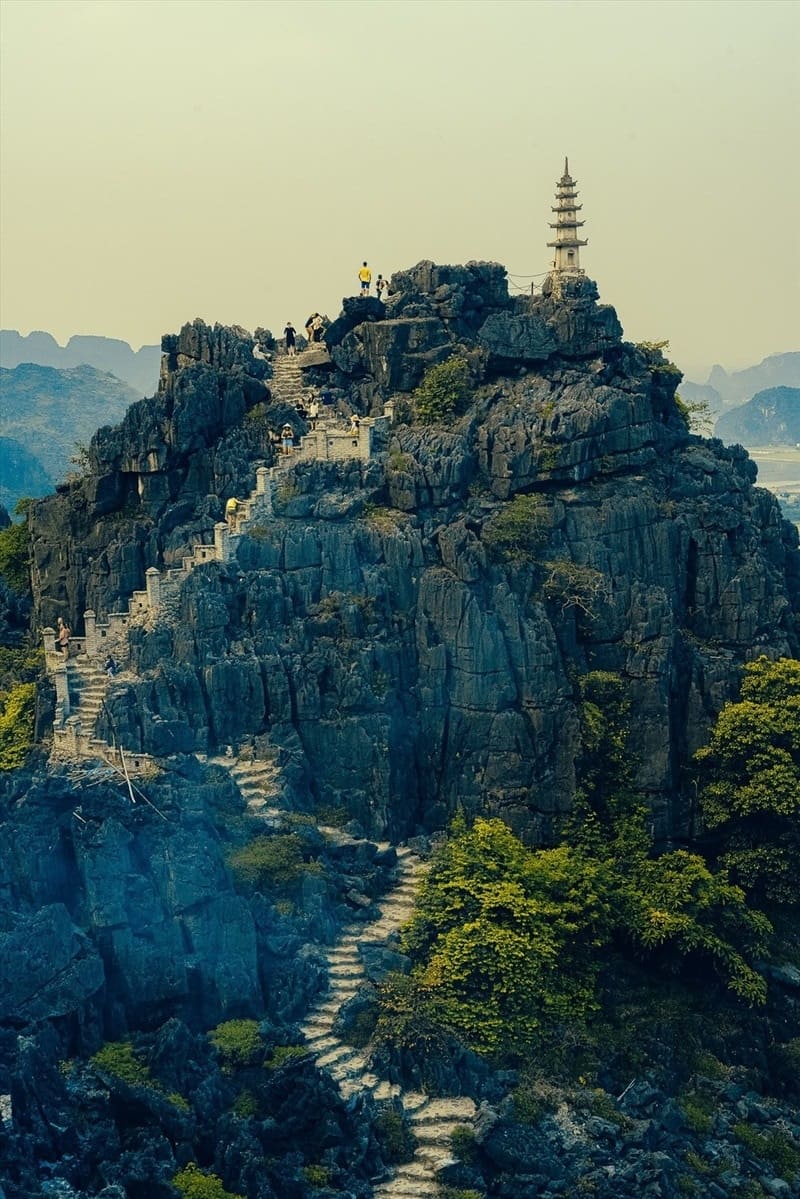
Panoramic view of Mua Cave and the surrounding landscape.
Essential Gear & Flycam Safety Regulations in Vietnam
Choosing Your Drone
Selecting the right drone is crucial for a successful aerial photography trip. Consider these factors:
- Portability: A lightweight and foldable drone is ideal for travel.
- Battery Life: Longer flight times allow for more creative exploration.
- Wind Resistance: Ninh Bình can experience windy conditions, so a drone with good wind resistance is essential.
Recommended Models: DJI Mini series (for portability and ease of use), DJI Air series (for a balance of features and performance).
Legal Compliance for Tourists
Flying drones in Vietnam is regulated. Here’s a summary of current regulations (as of late 2023/early 2024 – always check for updates before your trip):
- You generally need a permit from the Civil Aviation Authority of Vietnam (CAAV) for commercial drone operations.
- For recreational use, regulations are less strict, but you must still adhere to certain rules.
- No-Fly Zones: Strictly prohibited near military bases, airports, and restricted heritage sites. Tam Cốc and Trang An often have restrictions – check locally.
- Maximum altitude: 400 feet (120 meters).
- Drone must be registered.
- You are responsible for understanding and complying with all applicable laws.
Pre-Flight Checks
- Battery Management: Fully charge batteries and bring spares. Cold weather reduces battery performance.
- SD Card: Use a high-capacity, high-speed SD card to avoid recording issues.
- Calibration: Calibrate the drone’s compass before each flight.
- Weather Check: Avoid flying in rain, strong winds, or fog.
The Ultimate Flycam Photography Route and Key Locations
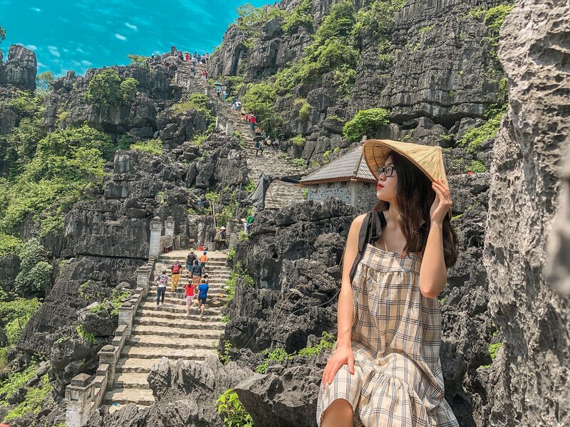
Location 1: Mua Cave Peak
Focus: Panoramic views and the winding path to the top.
Tip: Best time for sunrise/sunset shots. The golden light illuminates the landscape beautifully. Capture the dragon statue from above.
Location 2: Tam Cốc / Bích Động
Focus: Capturing the meandering boat traffic and rice fields.
Tip: Optimal altitude to frame the karst landscape and the boats. Be mindful of local regulations regarding flying over tourist boats.

Location 3: Van Long Nature Reserve
Focus: Wildlife spotting and the expansive wetland ecosystem.
Tip: Low-light flying considerations for this specific area. Be patient and scan the wetlands for Delacour’s langurs.

Post-Processing & Editing Your Aerial Masterpieces
- Color Grading for Tropical Light: Enhance vibrant greens and blues using software like Adobe Lightroom or Capture One.
- Stitching Panoramas: Software recommendations: PTGui, Adobe Photoshop.
- Sharpening and Noise Reduction: Best practices for high-altitude shots. Use noise reduction tools sparingly to avoid losing detail.
Frequently Asked Questions (FAQ)
| What is the best time of year to photograph Ninh Bình’s rice fields? | The best time to photograph the rice fields in Ninh Bình is typically late May to early June, during the harvest season. During this window, the fields turn a vibrant golden-yellow, offering a stunning contrast to the green limestone mountains. |
|---|---|
| Are drones allowed at Tam Cốc / Bích Động? | While regulations can change, flying a drone over popular tourist areas like Tam Cốc often requires prior authorization or strict adherence to altitude limits. It is advisable to check with your tour operator or local authorities before launching your drone. |
| How far is Ninh Bình from Hanoi? | Ninh Bình city is approximately 90 to 100 kilometers (about 60 miles) south of Hanoi. Travel time typically ranges from 1.5 to 2 hours by private car or train. |
| What unique feature makes Ninh Bình a great location for flycam photography? | Ninh Bình is uniquely known for its dramatically steep karst formations, which are scattered among flat riverine plains and wetlands. This topography, combined with the winding Ngô Đồng River, creates geometric patterns that are visually spectacular when viewed from above via a flycam. |
✈️ Book Your Ninh Bình Adventure Today!
Ready to experience the magic of Ninh Bình from a new perspective? Book your tour now and let us help you capture unforgettable aerial memories.
🏨 Find the Perfect Accommodation
Explore a wide range of hotels and resorts in Ninh Bình to suit your budget and preferences.
🚗 Rent a Car for Easy Exploration
Enjoy the freedom of exploring Ninh Bình at your own pace with a rental car.
🗺️ Get a Local SIM Card
Stay connected with a local SIM card for easy navigation and communication.
📸 Professional Photography Tours
Join a guided photography tour for expert tips and access to hidden gems.
🏥 Travel Insurance for Peace of Mind
Protect your trip with comprehensive travel insurance.